Don't think we'll be having too much beer on the deck #nlwx left this "summer". But man oh man it's nice.
 @isotachtics.bsky.social
 @isotachtics.bsky.social
Don't think we'll be having too much beer on the deck #nlwx left this "summer". But man oh man it's nice.
 @fluffyliverpool.bsky.social
Hey St. John’s, Mount Pearl. This looks like fun on a Sunday afternoon. #nlwx #nltraffic

 @eddiesheerr.bsky.social
After this morning's cool start, sunshine will help temps scoot up into the lower teens to lower 20s this afternoon across NL. #nlwx


 @rcbstormpost.bsky.social
A number of 20s on the list for Thursday's highs as broad high pressure continues to dominate #NLwx.

 @weathersourceca.bsky.social
The 🦆duck pond at Bowring Park in St. John's on Wednesday, September 23, 2026. #nlwx

 @eddiesheerr.bsky.social
High pressure remains a HUGE feature in our weather through the weekend. What about the nor'easter? Details in tonight's forecast from Swift Current, NL! #nlwx
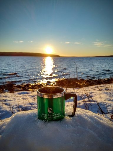
@isotachtics.bsky.socialTwo days in a row of brush cutter work here at Gander Disc Golf Course, and coincidentally, two days in a row for #TeaByTheSeaInTheTrees: Airport Nordic edition. #nlwx is making this work perfect to be out doing.

 @eddiesheerr.bsky.social
Another blue-bird day is on tap for the Province! #nlwx
@eddiesheerr.bsky.socialQuiet weather sets up shop as a large high builds into the region. What can we expect over the next few days and the weekend? I've got answers in today's video! #nlwx
@rcbstormpost.bsky.socialCool morning, but the start of a prolonged sunny spell for #NLwx! ☀️
Official overnight low of 2.5°C at Gander #YQX marked the coolest reading since June 12.
#GanderWest dipped to 1.9°C, its lowest since June 15.

 @pointforecaster.com
YELLOW ADVISORY - FROST ENDED, Corner Brook
Persons in or near this area should be on the lookout for adverse weather conditions and take necessary safety precautions. Issued: 6:45 AM NDT Wednesd...
https://pointforecaster.com/msc-weather-alerts/?city=Corner%20Brook
@pointforecaster.comYELLOW ADVISORY - FROST, Corner Brook
Persons in or near this area should be on the lookout for adverse weather conditions and take necessary safety precautions. Issued: 4:13 PM NDT Tuesday 22 Se...
https://pointforecaster.com/msc-weather-alerts/?city=Corner%20Brook
@eddiesheerr.bsky.socialRadar imagery continues to show areas of rain and showers across much of Newfoundland at this hour of the morning. The most widespread and intense activity has been, and continues to be, over the eastern sections. Most of this activity will end by 8 or 9 AM. #nlwx
@eddiesheerr.bsky.socialHighs today will peak in the single digits to mid-teens across the Province. A low-pressure area developing to our south and some energy moving across the Province from the north will bring rain and showers across the region today. #nlwx
 @eddiesheerr.bsky.social
More showers and even some rain are on the docket today. Check out the morning briefing for the most comprehensive weather outlook for Newfoundland and Labrador anywhere! #nlwx www.sheerrweather.ca/forecasts/mo...
 @shannonr709.bsky.social
What a gorgeous, fierce day at Middle Cove. 🌊 #nlwx #Newfoundland


