Photo, but make it geography.
 @map-shaped.bsky.social
 @map-shaped.bsky.social
Photo, but make it geography.
 @analyticaliowan.bsky.social
whiplash #midterms #politics #analyticaliowan #analyticaliowanpodcast #maps
 @pilgrimsonline.bsky.social
Where is Cyprus 🇨🇾?
#Cyprus
#StepByStep 👣
#PlacesOfWorship
Been here? ❤️
Want to visit? 🔁
#Maps #Cartography #Geography #OneWorld
3/6

 @bobmayer.bsky.social
How Not To Get Lost and What To Do If You Do. #camping #gettinglost #hikingadventures #campingworld #camping #maps youtu.be/d1XtVFaI9Qs
 @goodbirds-org.bsky.social
Explore all GoodBirds city maps 🗺️🐦 #ebird #birds #maps
https://goodbirds.org/cities_map.html
 @pilgrimsonline.bsky.social
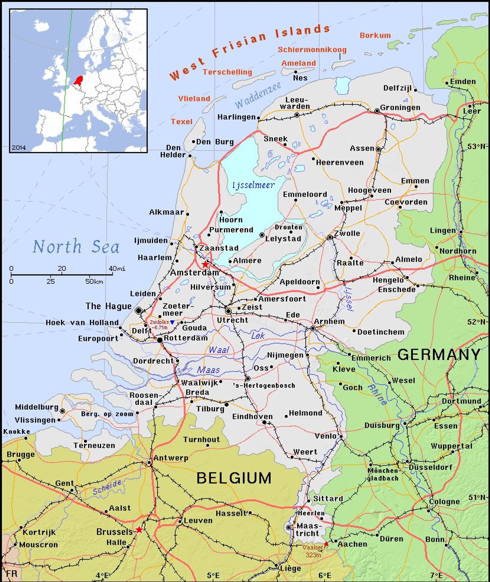
Where is the Netherlands 🇳🇱?
#Netherlands
#StepByStep 👣
#PlacesOfWorship
Been here? ❤️
Want to visit? 🔁
#Maps #Cartography #Geography #OneWorld
3/6
 @aaronjbecker.bsky.social
At 5 AM you can drive the length of Manhattan in 28 minutes. By 5 PM the same trip takes nearly 55.
On this map distance is drive time, so the island swells as the roads clog.
Method: Jeremy Vonderfecht. OpenStreetMap + Mapbox traffic.
 @bananafest-destiny.bsky.social
FTV Osprey went dark on a long haul when the main bus dropped and would not come back.
Today's free derelict, CC0: PNG + .dd2vtt (walls, doors, lights) + GM key.
bulkhead.bananafest-destiny.com/daily/2026-09-21/

 @exeterunispeccoll.bsky.social
This 'Plan of the City & Suburbs of Exeter', dating back to 1792, was surveyed by Charles Tozer and engraved by Thomas Yeakell.
Which landmarks can you identify that still exist today? And what has changed?
📷 Townsend Maps T16f
![Plan of Exeter, extending as far as St Thomas in the south and to the top of Sidwell Street in the north. It includes a legend to the churches in Exeter in the upper right corner and a dedication statement to the Mayor, Recorder, Sheriff, Aldermen and commonalty of Exeter in the upper left corner. It also features a drawing of a woman (goddess?), seated under a tree, holding a shield and wearing a blue dress, and indicating with her left hand towards the title and Rougemont Castle in the background. Near her left foot is a pile of books, including one marked 'Hist[or]y of Devon'. The plan is mostly shaded in greys and browns, with some accents in blue and yellow.](https://cdn.bsky.app/img/feed_fullsize/plain/did:plc:u3d3sbdevvp2kehpj6zyhzzn/bafkreibbia6gosxxhhprvige3htm7nx3gayjqvfyj4fdvd4g642fytf76i@jpeg)
 @uclsocialdata.bsky.social
"There's all sorts of choices and decisions that cartographers are making that gently steer us in one direction or another. And that's what makes them so powerful."
Check out James Cheshire's (SODA Director and Professor in @uclgeography.bsky.social) on BBC Radio Stoke 👇
@aaronjbecker.bsky.socialA line runs down the middle of America where green stops and tan begins, and it moves with the seasons. All 3,144 US counties, each filled with the average color of its own land, one frame per day, Jan 2025 to Sep 2026.
Data: NASA MODIS MOD09CMG
#maps #dataviz #satellite #geography
@pilgrimsonline.bsky.socialWhere is India 🇮🇳?
#India
#StepByStep 👣
#PlacesOfWorship
Been here? ❤️
Want to visit? 🔁
#Maps #Cartography #Geography #OneWorld
3/6
 @bananafest-destiny.bsky.social
5 derelicts from this week in one zip. PNG maps, .dd2vtt with walls, doors and lights for Foundry, Roll20 and Owlbear, and the GM key for each ship. CC0, no email, no account.


 @wokilbam21.bsky.social
Easy to understand El Niño.
What Is El Niño & Why Is It So Powerful 🌡️🤯 Super El Niño 🌊
Source: Geoglobel_tales #elnino #superelnino #pacificocean #geography #maps
 @pdimagearchive.bsky.social
Van Cortlandt Estate to be sold (1920) (1920).
Source: @nypl.bsky.social
https://pdimagearchive.org/images/df35ef92-b803-4a5c-a484-1e8ccbc0ce10
#maps #cartography #rivers #infrastructure #landscapes #mapmaking #art #publicdomain
 @pilgrimsonline.bsky.social
Where is Saint Kitts and Nevis 🇰🇳?
#SaintKittsandNevis
#StepByStep 👣
#PlacesOfWorship
Been here? ❤️
Want to visit? 🔁
#Maps #Cartography #Geography #OneWorld
3/6
 @aaronjbecker.bsky.social
How much of Europe is actually mountains? Half of it sits below 192 m, and only 1.6% clears 2,000 m. The Alps and the Caucasus are that thin sliver at the top. #Europe #geography #elevation #maps
 @encryptomatic.bsky.social