@lunalapin I wonder if they collab with #OpenStreetMap
 @babble-endanger.freeradical.zone.ap.brid.gy
 @babble-endanger.freeradical.zone.ap.brid.gy
@lunalapin I wonder if they collab with #OpenStreetMap
 @uneabeille.en.osm.town.ap.brid.gy
okay but what if someone actually made a userscipt to make it so you use right-click to pan in iD? 🤔
 @gul-laguna.bsky.social
🌎 " #OpenStreetMap : #DatosAbiertos y más"
Acompaña a Osvaldo R. Salazar S. en esta conferencia donde descubriremos el valor de los datos abiertos, el potencial de OpenStreetMap y las posibilidades que ofrece para crear, compartir y aprovechar información geográfica.

 @edouard-lopez.com
On parle de faire une cartopartie / panoramax en octobre à Orx le groupe locas #OpenstreetMap
Les infos sont par là: forum.openstreetmap.fr/t/oct-cartop...
cc @[email protected] @panoramax.bsky.social
#osm #cartopartie #sudlandes #paysbasque
 @comaps.app
New maps with OpenStreetMap data from September 13 are now out. Press "check for updates" in the app to see them in the app!

 @lcheylus.bsky.social
cartes.app, a french open-source Web alternative to Google Maps built on OSM, is now international - Talk by Maël Thomas-Quillévéré at State of the Map 2026 conference #OpenStreetMap #Video peertube.openstreetmap.fr/w/kp2xeiPwqF...
 @liotier.bsky.social
Abengourou - before/after... Gridding like it is 2016 !
www.openstreetmap.org/changeset/18... #Openstreetmap


OpenStreetMap data on an M5STACK CORE2 V1.1 SoC: Here it is: #ESP32 #GNSS #Satellite #Navigation #M5STACK #CORE2 #OpenStreetMap #OSM
www.elrebo.de/index.php/20...
 @fossgisev.mastodon.online.ap.brid.gy
Der Dresdner #OpenStreetMap Stammtisch ist am 19.09.2026 bei den #Datenspuren in Dresden dabei.
Kommt am Stand vorbei und fragt alles was Ihr schon immer zu #OSM und freier Software im Geobereich wissen wolltet.
#Datenspuren #Datenspuren2026 #FOSSGIS #OpenData #OpenSource

 @happy-homhom.bsky.social
OpenStreetMapに最初の1件を足すための、JOSM案内ページ
https://papoo.work/doc/7cad76cdff6a1144
#openstreetmap #地図編集 #josm #プラグイン #オープンデータ
 @geoobserver.bsky.social
#geoObserverTools: Neues/New Plugin „Duplicate Layer Remover“ geoobserver.de/2026/09/14/g... #qgis #plugin #switch2qgis #gistribe #gischat #fossgis #foss4g #OSGeo #spatial #geospatial #opendata #osm #openstreetmap #gis #geo #geoObserver pls RT

 @weeklyosm.bsky.social
👉 https://www.weeklyosm.eu/archives/18872 👈
Issue 842 of #weeklyOSM is out. 🌏
涵蓋 #開放街圖 #osm 世界大小事的新一期 weeklyOSM 已經發佈 🚀
Lisez les dernières nouvelles de l'univers #openstreetmap 🗺️
Viele Neuigkeiten aus der #osm Welt 📰
新一期的OSM周刊已经发布 🌏

 @giggls.bsky.geggus.net
It is possible to use something like this in OverpassTurbo
{{data:sql,server=http://localhost:8081/}}
Which is nice because I can now query my own #postgis database using the OverpassTurbo UI.
Did not find out how to do this in Overpass Ultra yet. Likely also possible.
#openstreetmap #postposs […]
 @sk53onosm.bsky.social
Also be aware that AFAIK the courtesy planning with snapping is based on #OpenStreetMap data not the Ordnance Survey's own data. Partly because OSGB has always shown #PRoWs as overlays.
There are gaps locally notably in the National Forest near Swad & parts of Long Lane beyond Longton.
 @jonpsp.mstdn.social.ap.brid.gy
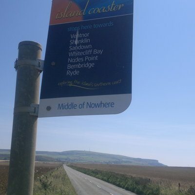
A walking route in a local residents magazine is trying to trigger me. Next to an uncredited map from #openStreetMap is a #What3Words reference.
@uneabeille.en.osm.town.ap.brid.gyI feel like #OpenStreetMap contributors who are cyclists will hate this: in Montreal, we have a novel (and evil) kind of rack that chomps down on your bike like some kind of monster with big teeth. I have no idea how to tag them, but I avoid them at all costs.
 @uneabeille.en.osm.town.ap.brid.gy
just #OpenStreetMap things: learning to identify the difference between a bocce court and a pétanque court based on shape and size
@sk53onosm.bsky.socialThis one I presume www.openstreetmap.org/node/289068884
We have 1371 postboxes without a cypher in the United Kingdom on #OpenStreetMap taginfo.geofabrik.de/europe:unite...
 @shionamasato.misskey.flowers.ap.brid.gy
埼玉県の数か所で『Esri World Imagery』に2026年撮影画像が存在することを確認しました。
最新の地物をマッピングされたい方はご活用ください。 #OpenStreetMap