Trail, lift & resort facts on globalskiatlas.com: faster load, country/state filters, map links, and lifts from the full worldwide file — not just eight countries. #skiing #indiedev #buildinpublic #GIS
 @globalskiatlas.bsky.social
 @globalskiatlas.bsky.social
Trail, lift & resort facts on globalskiatlas.com: faster load, country/state filters, map links, and lifts from the full worldwide file — not just eight countries. #skiing #indiedev #buildinpublic #GIS
 @apollomapping.bsky.social
Manhattan's tight street grid gives way to Roosevelt Island in this 5-meter color capture, with boat wakes streaking across the East River on both sides.
Search Image Hunter: imagehunter.apollomapping.com/

 @aitools2u.bsky.social
🌍 Geo Data Converter & Viewer
Built for GIS pros, developers, and drone operators:
• Convert between GeoJSON, KML/KMZ, and Shapefile
• Live interactive map layer preview
• Coordinate validation & projection fixes
 @foss4gna.bsky.social
FOSS4GNA B2B brings together #geospatial decision-makers, business leaders, and innovators. Featured speaker: Rishi Madhok, CEO of TerraByte, on geospatial AI, Earth observation, and the business of open source.
Nov 2 | 4:30–6:00 PM | Sacramento, CA
 @fotoshi.bsky.social
関西国際空港第2ターミナル国際線 | Airport Terminal by eneerhut on Fotoshi - 関西国際空港第2ターミナル国際線 is an airport terminal with check-in counters.
📍 Osaka, Japan
 @globalskiatlas.bsky.social
Trip planner on globalskiatlas.com is phone-friendlier: taps add a stop, selected resorts stay highlighted, and the panel slides up as a sheet. Weather map legend colors match the resort dots too. #skiing #indiedev #buildinpublic #GIS

 @rplsdotcom.bsky.social
ICYMI: Another Static check #Surveying #LandSurveying #GIS #CivilEngineering #UtilitySurvey
 @gisbandit.bsky.social
Rethinking Application Migrations w/ #ArcGIS #SDK for #JavaScript tinyurl.com/ymc8cwf3
#apps #GIS #esrijs #geodev #esridev #developers #esri #mapping #GISchat #geospatial #TheScienceOfWhere #geosky

 @qgis.fosstodon.org.ap.brid.gy
**One ticket just came back.**
QGIS User Conference 2026 in Laax has been sold out for months. One returned conference ticket is up for grabs (social dinner included, €495), plus 6 workshop tickets.
First come, first served 🏔️
👉 conference.qgis.org/tickets

 @igme1849.bsky.social
y datos #LiDAR para mejorar la modelización de desprendimientos e inestabilidades del terreno tras incendios forestales.
La IA ya está transformando el análisis geoespacial. Y nosotros queremos formar parte de ese cambio.

 @quarticle.bsky.social
What does it take to turn geospatial data into operational intelligence at enterprise scale?
At #Quarticle, we combine data, automation, expertise, and infrastructure to build production-ready #geospatial solutions.
 @fotoshi.bsky.social
Building, Ōsaka, Japan | Building by eneerhut on Fotoshi - This place is a building with food.
📍 Ōsaka, Japan

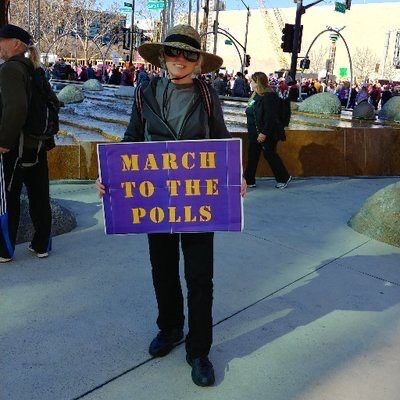 @vickyveritas.bsky.social
#MinCup26 ⚒️ sci-fi 🧪 🖖🏼 scifi Geosciences #WomenInSTEM geology #geosky #GIS 🍎 🪐 🔭 🌋 📚 🌿
@globalskiatlas.bsky.socialDrive-time map on globalskiatlas.com is phone-friendlier now: the map shows first, and the filters slide up as a sheet instead of covering the screen. #skiing #indiedev #buildinpublic #GIS
 @vickyveritas.bsky.social
#MinCup26 ⚒️ sci-fi 🧪 🖖🏼 scifi Geosciences #WomenInSTEM geology #geosky #GIS 🍎 🪐 🔭 🌋 📚 🌿
@apollomapping.bsky.socialA river winds through the Serengeti in this 5-meter color capture, its green banks standing out sharply against the drier grassland on either side.
Search Image Hunter: imagehunter.apollomapping.com/
 @vickyveritas.bsky.social
Never heard of Faden Quartz? You’re in for a treat!
#MinCup26 ⚒️ sci-fi 🧪 🖖🏼 scifi Geosciences #WomenInSTEM geology #geosky #GIS 🍎 🪐 🔭 🌋 📚 🌿
 @aasmith.bsky.social
I am normally not a neatline/border kinda guy, but I think with this USGS topo inspired map it works.
 @aitools2u.bsky.social
🌍 Geo Data Converter & Viewer
Built for GIS pros, developers, and drone operators:
• Convert between GeoJSON, KML/KMZ, and Shapefile
• Live interactive map layer preview
• Coordinate validation & projection fixes
 @ccsa-cuboulder.bsky.social